Our territory mapping system gives you multiple ways to define territories based on your business needs. Whether you're planning franchise territories, sales regions, or service areas, our flexible tools adapt to your requirements.
Draw directly on the map and generate powerful reports. This tool helps you visualize your franchise boundaries with ease.
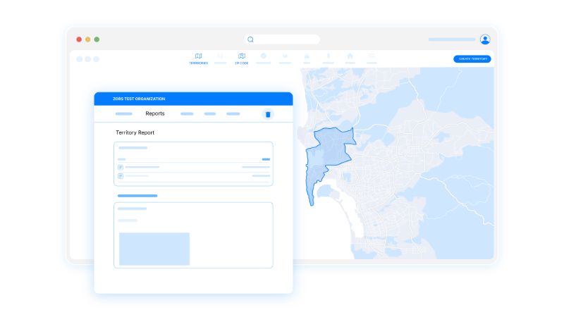 Generate territory reports
Choose the approach that works best for your business model. Draw custom shapes, select existing boundaries, or define by distance - all with the same intuitive interface.
Our territory mapping interface showing different territory creation methods
Once your territories are defined, our system automatically generates demographic and economic analysis based on the latest census data. Understand the population, income levels, housing statistics, and business activity within each territory.
Compare territories side-by-side to ensure equitable distribution and identify high-potential areas for expansion.
Already have territory definitions in spreadsheets or other formats? Our import tools make it easy to bring your existing data into the system and visualize it immediately.
Use built-in visualization tools to spot trends and make informed decisions about territory adjustments and expansion opportunities.
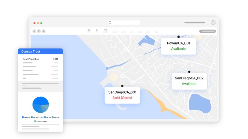
Simply select the zip code mapping tool, search for specific zip codes, and click to add them to your territory. You can select multiple zip codes and our system will automatically create the boundary visualization.
Yes! You can import territory data from CSV files, Excel spreadsheets, or other mapping software. Our import wizard helps you match your data fields and visualize territories immediately.
Our platform includes comprehensive US Census and American Community Survey data including population, income levels, age demographics, housing statistics, and business activity metrics for each territory.
Our mapping uses Census Bureau ZIP Code Tabulation Areas (ZCTAs) from TIGER/Line shapefiles and Census tract boundaries, ensuring the highest level of accuracy. Territory visualizations are updated regularly to reflect any boundary changes.
Enhance your territory mapping with these powerful complementary features:
Generate comprehensive demographic reports for your mapped territories with census data and economic indicators.
Manage franchise prospects and relationships within your mapped territories using our integrated CRM system.
Create detailed territory reports and visualizations to support your franchise development strategy.
Learn more about our complete platform features or explore franchise territory mapping best practices in our blog.